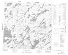
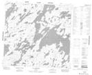
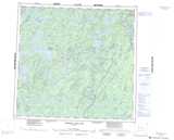
Maps showing Lac Brochet 197A, Manitoba
Lac Brochet 197A is a Indian Reserve located in Manitoba.
- Latitude: 58° 36' 58'' North (decimal: 58.6160999)
- Longitude: 101° 30' 00'' West (decimal: -101.4999999)
- Topography Feature Category: Indian Reserve
- Geographical Feature: Indian Reserve - Réserve indienne
- Canadian Province/Territory: Manitoba
- Atlas of Canada Locator Map: Lac Brochet 197A
- GPS Coordinate Locator Map: Lac Brochet 197A Lat/Long
Lac Brochet 197A NTS Map Sheets