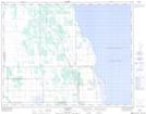
Maps showing Sandy Bay 5, Manitoba
Sandy Bay 5 is a Indian Reserve located in Manitoba.
- Latitude: 50° 33' 1'' North (decimal: 50.5502999)
- Longitude: 98° 39' 57'' West (decimal: -98.6658000)
- Topography Feature Category: Indian Reserve
- Geographical Feature: Indian Reserve - Réserve indienne
- Canadian Province/Territory: Manitoba
- Atlas of Canada Locator Map: Sandy Bay 5
- GPS Coordinate Locator Map: Sandy Bay 5 Lat/Long