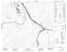
Maps showing Shamattawa 1, Manitoba
Shamattawa 1 is a Indian Reserve located in Manitoba.
- Latitude: 55° 51' 30'' North (decimal: 55.8582999)
- Longitude: 92° 5' 46'' West (decimal: -92.0961000)
- Topography Feature Category: Indian Reserve
- Geographical Feature: Indian Reserve - Réserve indienne
- Canadian Province/Territory: Manitoba
- Atlas of Canada Locator Map: Shamattawa 1
- GPS Coordinate Locator Map: Shamattawa 1 Lat/Long
Shamattawa 1 NTS Map Sheets