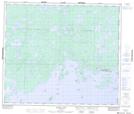
Maps showing God's River 86A, Manitoba
God's River 86A is a Indian Reserve located in Manitoba.
- Latitude: 54° 50' 15'' North (decimal: 54.8374999)
- Longitude: 94° 3' 17'' West (decimal: -94.0547000)
- Topography Feature Category: Indian Reserve
- Geographical Feature: Indian Reserve - Réserve indienne
- Canadian Province/Territory: Manitoba
- Atlas of Canada Locator Map: God's River 86A
- GPS Coordinate Locator Map: God's River 86A Lat/Long
God's River 86A NTS Map Sheets