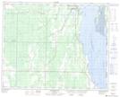
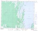
Maps showing Pine Creek 66A, Manitoba
Pine Creek 66A is a Indian Reserve located in Manitoba.
- Latitude: 52° 3' 34'' North (decimal: 52.0594000)
- Longitude: 100° 11' 48'' West (decimal: -100.1967000)
- Topography Feature Category: Indian Reserve
- Geographical Feature: Indian Reserve - Réserve indienne
- Canadian Province/Territory: Manitoba
- Atlas of Canada Locator Map: Pine Creek 66A
- GPS Coordinate Locator Map: Pine Creek 66A Lat/Long
Pine Creek 66A NTS Map Sheets