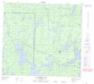
Maps showing Black Sturgeon, 90,91-20-W, Manitoba
Black Sturgeon is a Indian Reserve located in 90,91-20-W, Manitoba.
- Latitude: 56° 49' 53'' North (decimal: 56.8313999)
- Longitude: 100° 34' 15'' West (decimal: -100.5707999)
- Topography Feature Category: Indian Reserve
- Geographical Feature: Indian Reserve - Réserve indienne
- Canadian Province/Territory: Manitoba
- Location: 90,91-20-W
- Atlas of Canada Locator Map: Black Sturgeon
- GPS Coordinate Locator Map: Black Sturgeon Lat/Long
Black Sturgeon NTS Map Sheets