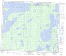
Maps showing Opaskwayak Cree Nation 21L, Manitoba
Opaskwayak Cree Nation 21L is a Indian Reserve located in Manitoba.
- Latitude: 54° 6' 2'' North (decimal: 54.1006000)
- Longitude: 101° 33' 48'' West (decimal: -101.5632999)
- Topography Feature Category: Indian Reserve
- Geographical Feature: Indian Reserve - Réserve indienne
- Canadian Province/Territory: Manitoba
- Atlas of Canada Locator Map: Opaskwayak Cree Nation 21L
- GPS Coordinate Locator Map: Opaskwayak Cree Nation 21L Lat/Long
Opaskwayak Cree Nation 21L NTS Map Sheets