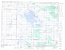
Maps showing Canupawakpa Dakota First Nation, Manitoba
Canupawakpa Dakota First Nation is a Indian Reserve located in Manitoba.
- Latitude: 49° 37' 26'' North (decimal: 49.6239000)
- Longitude: 100° 55' 58'' West (decimal: -100.9328000)
- Topography Feature Category: Indian Reserve
- Geographical Feature: Indian Reserve - Réserve indienne
- Canadian Province/Territory: Manitoba
- Atlas of Canada Locator Map: Canupawakpa Dakota First Nation
- GPS Coordinate Locator Map: Canupawakpa Dakota First Nation Lat/Long