Maps showing Garden Hill First Nation, Manitoba
Garden Hill First Nation is a Indian Reserve located in Manitoba.
- Latitude: 53° 52' 17'' North (decimal: 53.8714000)
- Longitude: 94° 38' 27'' West (decimal: -94.6408000)
- Topography Feature Category: Indian Reserve
- Geographical Feature: Indian Reserve - Réserve indienne
- Canadian Province/Territory: Manitoba
- Atlas of Canada Locator Map: Garden Hill First Nation
- GPS Coordinate Locator Map: Garden Hill First Nation Lat/Long
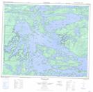
Garden Hill First Nation NTS Map Sheets