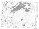
Maps showing Naytawunkank, Manitoba
Naytawunkank is a Indian Reserve located in Manitoba.
- Latitude: 53° 38' 30'' North (decimal: 53.6417000)
- Longitude: 95° 45' 15'' West (decimal: -95.7541999)
- Topography Feature Category: Indian Reserve
- Geographical Feature: Indian Reserve - Réserve indienne
- Canadian Province/Territory: Manitoba
- Atlas of Canada Locator Map: Naytawunkank
- GPS Coordinate Locator Map: Naytawunkank Lat/Long
Naytawunkank NTS Map Sheets