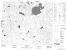
Maps showing Cantin Lake, Manitoba
Cantin Lake is a Indian Reserve located in Manitoba.
- Latitude: 53° 25' 30'' North (decimal: 53.4250000)
- Longitude: 95° 9' 0'' West (decimal: -95.1500000)
- Topography Feature Category: Indian Reserve
- Geographical Feature: Indian Reserve - Réserve indienne
- Canadian Province/Territory: Manitoba
- Atlas of Canada Locator Map: Cantin Lake
- GPS Coordinate Locator Map: Cantin Lake Lat/Long
Cantin Lake NTS Map Sheets