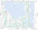
Maps showing Red Deer Point Drain, 4- 32- 18- W, Manitoba
Red Deer Point Drain is a Hydraulic construction located in 4- 32- 18- W, Manitoba.
- Latitude: 51° 43' 4'' North (decimal: 51.7177776)
- Longitude: 99° 57' 3'' West (decimal: -99.9508331)
- Topography Feature Category: Hydraulic construction
- Geographical Feature: Drain
- Canadian Province/Territory: Manitoba
- Location: 4- 32- 18- W
- Atlas of Canada Locator Map: Red Deer Point Drain
- GPS Coordinate Locator Map: Red Deer Point Drain Lat/Long
Red Deer Point Drain NTS Map Sheets