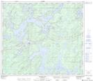
Maps showing Timew Island, Manitoba
Timew Island is a Island located in Manitoba.
- Latitude: 55° 56' 30'' North (decimal: 55.9416666)
- Longitude: 99° 16' 42'' West (decimal: -99.2783333)
- Topography Feature Category: Island
- Geographical Feature: Island
- Canadian Province/Territory: Manitoba
- Atlas of Canada Locator Map: Timew Island
- GPS Coordinate Locator Map: Timew Island Lat/Long
Timew Island NTS Map Sheets