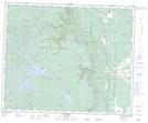
Maps showing Wuskwi Sipihk 8, Manitoba
Wuskwi Sipihk 8 is a Indian Reserve located in Manitoba.
- Latitude: 52° 36' 30'' North (decimal: 52.6082334)
- Longitude: 101° 23' 26'' West (decimal: -101.3904406)
- Topography Feature Category: Indian Reserve
- Geographical Feature: Indian Reserve - Réserve indienne
- Canadian Province/Territory: Manitoba
- Atlas of Canada Locator Map: Wuskwi Sipihk 8
- GPS Coordinate Locator Map: Wuskwi Sipihk 8 Lat/Long