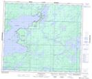
Maps showing Oxford Lake North Shore, Manitoba
Oxford Lake North Shore is a Indian Reserve located in Manitoba.
- Latitude: 54° 57' 33'' North (decimal: 54.9591431)
- Longitude: 95° 21' 59'' West (decimal: -95.3665073)
- Topography Feature Category: Indian Reserve
- Geographical Feature: Indian Reserve - Réserve indienne
- Canadian Province/Territory: Manitoba
- Atlas of Canada Locator Map: Oxford Lake North Shore
- GPS Coordinate Locator Map: Oxford Lake North Shore Lat/Long
Oxford Lake North Shore NTS Map Sheets