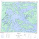
Maps showing Bella Lake Exchange Lands, Manitoba
Bella Lake Exchange Lands is a Indian Reserve located in Manitoba.
- Latitude: 53° 53' 3'' North (decimal: 53.8841666)
- Longitude: 94° 33' 10'' West (decimal: -94.5527776)
- Topography Feature Category: Indian Reserve
- Geographical Feature: Indian Reserve - Réserve indienne
- Canadian Province/Territory: Manitoba
- Atlas of Canada Locator Map: Bella Lake Exchange Lands
- GPS Coordinate Locator Map: Bella Lake Exchange Lands Lat/Long
Bella Lake Exchange Lands NTS Map Sheets