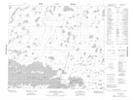
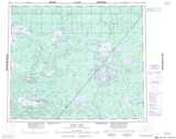
Maps showing Hurley Island, Manitoba
Hurley Island is a Indian Reserve located in Manitoba.
- Latitude: 54° 47' 10'' North (decimal: 54.7861111)
- Longitude: 93° 45' 10'' West (decimal: -93.7527776)
- Topography Feature Category: Indian Reserve
- Geographical Feature: Indian Reserve - Réserve indienne
- Canadian Province/Territory: Manitoba
- Atlas of Canada Locator Map: Hurley Island
- GPS Coordinate Locator Map: Hurley Island Lat/Long
Hurley Island NTS Map Sheets