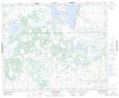
Maps showing Suffern Lake Regional Park, 13,24,25-42,44-27-W3, Saskatchewan
Suffern Lake Regional Park is a Conservation area located in 13,24,25-42,44-27-W3, Saskatchewan and has an elevation of 631 meters.
- Latitude: 52° 38' 30'' North (decimal: 52.6417421)
- Longitude: 109° 54' 3'' West (decimal: -109.9007671)
- Topography Feature Category: Conservation area
- Geographical Feature: Regional Park
- Canadian Province/Territory: Saskatchewan
- Elevation: 631 meters
- Location: 13,24,25-42,44-27-W3
- Atlas of Canada Locator Map: Suffern Lake Regional Park
- GPS Coordinate Locator Map: Suffern Lake Regional Park Lat/Long
Suffern Lake Regional Park NTS Map Sheets