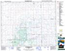
Maps showing Day Star Lakes, Saskatchewan
Day Star Lakes is a Lake located in Saskatchewan and has an elevation of 650 meters.
- Latitude: 51° 32' North (decimal: 51.5333621)
- Longitude: 104° 17' West (decimal: -104.2838742)
- Topography Feature Category: Lake
- Geographical Feature: Lakes
- Canadian Province/Territory: Saskatchewan
- Elevation: 650 meters
- Atlas of Canada Locator Map: Day Star Lakes
- GPS Coordinate Locator Map: Day Star Lakes Lat/Long
Day Star Lakes NTS Map Sheets