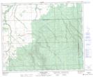
Maps showing Fournier Creek, 20-49-9-W2M, Saskatchewan
Fournier Creek is a River located in 20-49-9-W2M, Saskatchewan and has an elevation of 335 meters.
- Latitude: 53° 14' North (decimal: 53.2333630)
- Longitude: 103° 17' West (decimal: -103.2838050)
- Topography Feature Category: River
- Geographical Feature: Creek
- Canadian Province/Territory: Saskatchewan
- Elevation: 335 meters
- Location: 20-49-9-W2M
- Atlas of Canada Locator Map: Fournier Creek
- GPS Coordinate Locator Map: Fournier Creek Lat/Long
Fournier Creek NTS Map Sheets