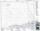
Maps showing Lemsford Ferry Regional Park, 2,3,l0,ll-24-23-3, Saskatchewan
Lemsford Ferry Regional Park is a Conservation area located in 2,3,l0,ll-24-23-3, Saskatchewan and has an elevation of 594 meters.
- Latitude: 51° 2' 5'' North (decimal: 51.0346321)
- Longitude: 109° 10' 43'' West (decimal: -109.1786179)
- Topography Feature Category: Conservation area
- Geographical Feature: Regional Park
- Canadian Province/Territory: Saskatchewan
- Elevation: 594 meters
- Location: 2,3,l0,ll-24-23-3
- Atlas of Canada Locator Map: Lemsford Ferry Regional Park
- GPS Coordinate Locator Map: Lemsford Ferry Regional Park Lat/Long