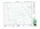
Maps showing Markham's Crater Lake, 2-23-4-W2, Saskatchewan
Markham's Crater Lake is a Lake located in 2-23-4-W2, Saskatchewan and has an elevation of 521 meters.
- Latitude: 50° 57' North (decimal: 50.9500017)
- Longitude: 102° 27' West (decimal: -102.4504822)
- Topography Feature Category: Lake
- Geographical Feature: Lake
- Canadian Province/Territory: Saskatchewan
- Elevation: 521 meters
- Location: 2-23-4-W2
- Atlas of Canada Locator Map: Markham's Crater Lake
- GPS Coordinate Locator Map: Markham's Crater Lake Lat/Long
Markham's Crater Lake NTS Map Sheets