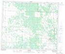
Maps showing Norbury Creek, 12-51-11-W3, Saskatchewan
Norbury Creek is a River located in 12-51-11-W3, Saskatchewan and has an elevation of 610 meters.
- Latitude: 53° 23' 30'' North (decimal: 53.3917295)
- Longitude: 107° 29' 57'' West (decimal: -107.4992251)
- Topography Feature Category: River
- Geographical Feature: Creek
- Canadian Province/Territory: Saskatchewan
- Elevation: 610 meters
- Location: 12-51-11-W3
- Atlas of Canada Locator Map: Norbury Creek
- GPS Coordinate Locator Map: Norbury Creek Lat/Long