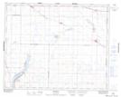
Maps showing Shields, 33-3-W3, Saskatchewan
Shields is a Village located in 33-3-W3, Saskatchewan and has an elevation of 543 meters.
- Latitude: 51° 49' 10'' North (decimal: 51.8195528)
- Longitude: 106° 24' 17'' West (decimal: -106.4047082)
- Topography Feature Category: Village
- Geographical Feature: Resort Village
- Canadian Province/Territory: Saskatchewan
- Elevation: 543 meters
- Location: 33-3-W3
- Atlas of Canada Locator Map: Shields
- GPS Coordinate Locator Map: Shields Lat/Long