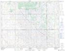
Maps showing South Touchwood, 13-25-16-W2, Saskatchewan
South Touchwood is a Unincorporated area located in 13-25-16-W2, Saskatchewan and has an elevation of 654 meters.
- Latitude: 51° 8' North (decimal: 51.1333730)
- Longitude: 104° 7' West (decimal: -104.1172081)
- Topography Feature Category: Unincorporated area
- Geographical Feature: Locality
- Canadian Province/Territory: Saskatchewan
- Elevation: 654 meters
- Location: 13-25-16-W2
- Atlas of Canada Locator Map: South Touchwood
- GPS Coordinate Locator Map: South Touchwood Lat/Long