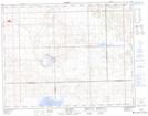
Maps showing Ingebrigt Lake, 16-25-W3, Saskatchewan
Ingebrigt Lake is a Lake located in 16-25-W3, Saskatchewan and has an elevation of 701 meters.
- Latitude: 50° 22' North (decimal: 50.3667135)
- Longitude: 109° 19' West (decimal: -109.3174159)
- Topography Feature Category: Lake
- Geographical Feature: Lake
- Canadian Province/Territory: Saskatchewan
- Elevation: 701 meters
- Location: 16-25-W3
- Atlas of Canada Locator Map: Ingebrigt Lake
- GPS Coordinate Locator Map: Ingebrigt Lake Lat/Long