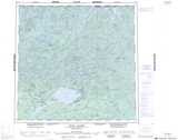
Maps showing Little Grollier Lake, Saskatchewan
Little Grollier Lake is a Lake located in Saskatchewan and has an elevation of 460 meters.
- Latitude: 59° 45' North (decimal: 59.7501835)
- Longitude: 105° 25' West (decimal: -105.4173397)
- Topography Feature Category: Lake
- Geographical Feature: Lake
- Canadian Province/Territory: Saskatchewan
- Elevation: 460 meters
- Atlas of Canada Locator Map: Little Grollier Lake
- GPS Coordinate Locator Map: Little Grollier Lake Lat/Long
Little Grollier Lake NTS Map Sheets