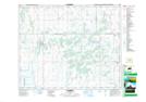
Maps showing Pathlow, 23-43-20-W2, Saskatchewan
Pathlow is a Hamlet located in 23-43-20-W2, Saskatchewan and has an elevation of 503 meters.
- Latitude: 52° 43' North (decimal: 52.7166798)
- Longitude: 104° 48' West (decimal: -104.8005001)
- Topography Feature Category: Hamlet
- Geographical Feature: Hamlet
- Canadian Province/Territory: Saskatchewan
- Elevation: 503 meters
- Location: 23-43-20-W2
- Atlas of Canada Locator Map: Pathlow
- GPS Coordinate Locator Map: Pathlow Lat/Long