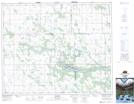
Maps showing Kwatapiu Lake, 42-16,17-W2, Saskatchewan
Kwatapiu Lake is a Lake located in 42-16,17-W2, Saskatchewan and has an elevation of 526 meters.
- Latitude: 52° 37' North (decimal: 52.6166735)
- Longitude: 104° 19' West (decimal: -104.3171612)
- Topography Feature Category: Lake
- Geographical Feature: Lake
- Canadian Province/Territory: Saskatchewan
- Elevation: 526 meters
- Location: 42-16,17-W2
- Atlas of Canada Locator Map: Kwatapiu Lake
- GPS Coordinate Locator Map: Kwatapiu Lake Lat/Long