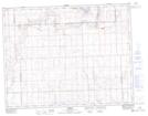
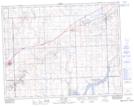
Maps showing Ferguson Bay, Saskatchewan
Ferguson Bay is a Bay located in Saskatchewan and has an elevation of 809 meters.
- Latitude: 50° 0' North (decimal: 50.0000329)
- Longitude: 108° 7' West (decimal: -108.1173567)
- Topography Feature Category: Bay
- Geographical Feature: Bay
- Canadian Province/Territory: Saskatchewan
- Elevation: 809 meters
- Atlas of Canada Locator Map: Ferguson Bay
- GPS Coordinate Locator Map: Ferguson Bay Lat/Long
Ferguson Bay NTS Map Sheets