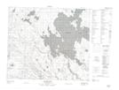
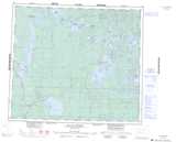
Maps showing Agumik Creek, Saskatchewan
Agumik Creek is a River located in Saskatchewan and has an elevation of 399 meters.
- Latitude: 55° 24' North (decimal: 55.4000791)
- Longitude: 106° 48' West (decimal: -106.8005978)
- Topography Feature Category: River
- Geographical Feature: Creek
- Canadian Province/Territory: Saskatchewan
- Elevation: 399 meters
- Atlas of Canada Locator Map: Agumik Creek
- GPS Coordinate Locator Map: Agumik Creek Lat/Long
Agumik Creek NTS Map Sheets