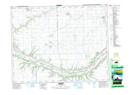
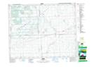
Maps showing Abernethy, 25-20-11-W2, Saskatchewan
Abernethy is a Village located in 25-20-11-W2, Saskatchewan and has an elevation of 584 meters.
- Latitude: 50° 44' 40'' North (decimal: 50.7445278)
- Longitude: 103° 25' 5'' West (decimal: -103.4181630)
- Topography Feature Category: Village
- Geographical Feature: Village
- Canadian Province/Territory: Saskatchewan
- Elevation: 584 meters
- Location: 25-20-11-W2
- Atlas of Canada Locator Map: Abernethy
- GPS Coordinate Locator Map: Abernethy Lat/Long
Abernethy NTS Map Sheets