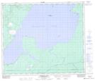
Maps showing Alberts Lake, 68-23-W3, Saskatchewan
Alberts Lake is a Lake located in 68-23-W3, Saskatchewan and has an elevation of 608 meters.
- Latitude: 54° 54' North (decimal: 54.9000847)
- Longitude: 109° 29' West (decimal: -109.4841546)
- Topography Feature Category: Lake
- Geographical Feature: Lake
- Canadian Province/Territory: Saskatchewan
- Elevation: 608 meters
- Location: 68-23-W3
- Atlas of Canada Locator Map: Alberts Lake
- GPS Coordinate Locator Map: Alberts Lake Lat/Long
Alberts Lake NTS Map Sheets