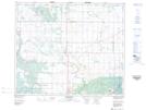
Maps showing Albertville, 12,13-51-25-W2; 7,18-51-24-W2, Saskatchewan
Albertville is a Village located in 12,13-51-25-W2; 7,18-51-24-W2, Saskatchewan and has an elevation of 487 meters.
- Latitude: 53° 23' 40'' North (decimal: 53.3944528)
- Longitude: 105° 32' 18'' West (decimal: -105.5382639)
- Topography Feature Category: Village
- Geographical Feature: Village
- Canadian Province/Territory: Saskatchewan
- Elevation: 487 meters
- Location: 12,13-51-25-W2; 7,18-51-24-W2
- Atlas of Canada Locator Map: Albertville
- GPS Coordinate Locator Map: Albertville Lat/Long
Albertville NTS Map Sheets