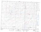
Maps showing Alida, 16-5-33-W, Saskatchewan
Alida is a Village located in 16-5-33-W, Saskatchewan and has an elevation of 571 meters.
- Latitude: 49° 23' 20'' North (decimal: 49.3890055)
- Longitude: 101° 52' 27'' West (decimal: -101.8742889)
- Topography Feature Category: Village
- Geographical Feature: Village
- Canadian Province/Territory: Saskatchewan
- Elevation: 571 meters
- Location: 16-5-33-W
- Atlas of Canada Locator Map: Alida
- GPS Coordinate Locator Map: Alida Lat/Long