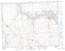
Maps showing Antelope Creek, 20-17-W3, Saskatchewan
Antelope Creek is a River located in 20-17-W3, Saskatchewan and has an elevation of 684 meters.
- Latitude: 50° 42' North (decimal: 50.7000437)
- Longitude: 108° 20' West (decimal: -108.3340318)
- Topography Feature Category: River
- Geographical Feature: Creek
- Canadian Province/Territory: Saskatchewan
- Elevation: 684 meters
- Location: 20-17-W3
- Atlas of Canada Locator Map: Antelope Creek
- GPS Coordinate Locator Map: Antelope Creek Lat/Long