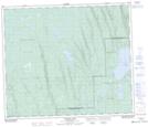
Maps showing Carl Creek, 15-64-18-W3, Saskatchewan
Carl Creek is a River located in 15-64-18-W3, Saskatchewan and has an elevation of 672 meters.
- Latitude: 54° 32' North (decimal: 54.5334263)
- Longitude: 108° 38' West (decimal: -108.6340748)
- Topography Feature Category: River
- Geographical Feature: Creek
- Canadian Province/Territory: Saskatchewan
- Elevation: 672 meters
- Location: 15-64-18-W3
- Atlas of Canada Locator Map: Carl Creek
- GPS Coordinate Locator Map: Carl Creek Lat/Long
Carl Creek NTS Map Sheets