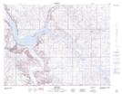
Maps showing Carlisle Coulee, 1-21,22-W2, Saskatchewan
Carlisle Coulee is a Valley located in 1-21,22-W2, Saskatchewan and has an elevation of 693 meters.
- Latitude: 49° 1' North (decimal: 49.0166963)
- Longitude: 104° 48' West (decimal: -104.8005250)
- Topography Feature Category: Valley
- Geographical Feature: Coulee
- Canadian Province/Territory: Saskatchewan
- Elevation: 693 meters
- Location: 1-21,22-W2
- Atlas of Canada Locator Map: Carlisle Coulee
- GPS Coordinate Locator Map: Carlisle Coulee Lat/Long
Carlisle Coulee NTS Map Sheets