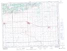
Maps showing Carlyle, 7-8-2-W2, Saskatchewan
Carlyle is a Town located in 7-8-2-W2, Saskatchewan and has an elevation of 629 meters.
- Latitude: 49° 38' 7'' North (decimal: 49.6353911)
- Longitude: 102° 15' 59'' West (decimal: -102.2663555)
- Topography Feature Category: Town
- Geographical Feature: Town
- Canadian Province/Territory: Saskatchewan
- Elevation: 629 meters
- Location: 7-8-2-W2
- Atlas of Canada Locator Map: Carlyle
- GPS Coordinate Locator Map: Carlyle Lat/Long