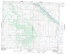
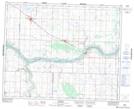
Maps showing Arelee, 10-38-11-W3, Saskatchewan
Arelee is a Unincorporated area located in 10-38-11-W3, Saskatchewan and has an elevation of 541 meters.
- Latitude: 52° 15' North (decimal: 52.2500528)
- Longitude: 107° 30' West (decimal: -107.5006459)
- Topography Feature Category: Unincorporated area
- Geographical Feature: Hamlet
- Canadian Province/Territory: Saskatchewan
- Elevation: 541 meters
- Location: 10-38-11-W3
- Atlas of Canada Locator Map: Arelee
- GPS Coordinate Locator Map: Arelee Lat/Long
Arelee NTS Map Sheets