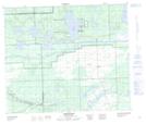
Maps showing First Mustus Lake, 9-63-19-W3, Saskatchewan
First Mustus Lake is a Lake located in 9-63-19-W3, Saskatchewan and has an elevation of 477 meters.
- Latitude: 54° 26' North (decimal: 54.4334289)
- Longitude: 108° 49' West (decimal: -108.8174213)
- Topography Feature Category: Lake
- Geographical Feature: Lake
- Canadian Province/Territory: Saskatchewan
- Elevation: 477 meters
- Location: 9-63-19-W3
- Atlas of Canada Locator Map: First Mustus Lake
- GPS Coordinate Locator Map: First Mustus Lake Lat/Long
First Mustus Lake NTS Map Sheets