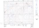
Maps showing Flaxcombe, 16-29-26-W3, Saskatchewan
Flaxcombe is a Village located in 16-29-26-W3, Saskatchewan and has an elevation of 731 meters.
- Latitude: 51° 28' 37'' North (decimal: 51.4769277)
- Longitude: 109° 36' 26'' West (decimal: -109.6070860)
- Topography Feature Category: Village
- Geographical Feature: Village
- Canadian Province/Territory: Saskatchewan
- Elevation: 731 meters
- Location: 16-29-26-W3
- Atlas of Canada Locator Map: Flaxcombe
- GPS Coordinate Locator Map: Flaxcombe Lat/Long