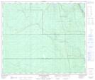
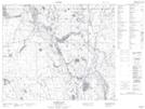
Maps showing Ispuchaw Lake, 58-18,19-W2, Saskatchewan
Ispuchaw Lake is a Lake located in 58-18,19-W2, Saskatchewan and has an elevation of 526 meters.
- Latitude: 54° 0' North (decimal: 54.0000569)
- Longitude: 104° 41' West (decimal: -104.6837705)
- Topography Feature Category: Lake
- Geographical Feature: Lake
- Canadian Province/Territory: Saskatchewan
- Elevation: 526 meters
- Location: 58-18,19-W2
- Atlas of Canada Locator Map: Ispuchaw Lake
- GPS Coordinate Locator Map: Ispuchaw Lake Lat/Long
Ispuchaw Lake NTS Map Sheets