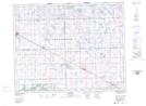
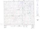
Maps showing Ituna, 21-25-11-W2, Saskatchewan
Ituna is a Town located in 21-25-11-W2, Saskatchewan and has an elevation of 671 meters.
- Latitude: 51° 10' 5'' North (decimal: 51.1681442)
- Longitude: 103° 29' 54'' West (decimal: -103.4984639)
- Topography Feature Category: Town
- Geographical Feature: Town
- Canadian Province/Territory: Saskatchewan
- Elevation: 671 meters
- Location: 21-25-11-W2
- Atlas of Canada Locator Map: Ituna
- GPS Coordinate Locator Map: Ituna Lat/Long
Ituna NTS Map Sheets