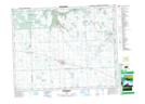
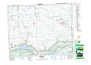
Maps showing Iskwaohead Creek, Saskatchewan
Iskwaohead Creek is a River located in Saskatchewan and has an elevation of 441 meters.
- Latitude: 50° 31' North (decimal: 50.5166774)
- Longitude: 102° 17' West (decimal: -102.2838229)
- Topography Feature Category: River
- Geographical Feature: Creek
- Canadian Province/Territory: Saskatchewan
- Elevation: 441 meters
- Atlas of Canada Locator Map: Iskwaohead Creek
- GPS Coordinate Locator Map: Iskwaohead Creek Lat/Long
Iskwaohead Creek NTS Map Sheets