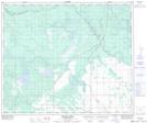
Maps showing Jacquine Lake, 53-19-W2, Saskatchewan
Jacquine Lake is a Lake located in 53-19-W2, Saskatchewan and has an elevation of 454 meters.
- Latitude: 53° 34' North (decimal: 53.5667147)
- Longitude: 104° 44' West (decimal: -104.7338010)
- Topography Feature Category: Lake
- Geographical Feature: Lake
- Canadian Province/Territory: Saskatchewan
- Elevation: 454 meters
- Location: 53-19-W2
- Atlas of Canada Locator Map: Jacquine Lake
- GPS Coordinate Locator Map: Jacquine Lake Lat/Long
Jacquine Lake NTS Map Sheets