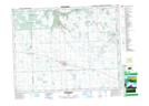
Maps showing Forest Farm, 17-17-1-W2, Saskatchewan
Forest Farm is a Unincorporated area located in 17-17-1-W2, Saskatchewan and has an elevation of 595 meters.
- Latitude: 50° 26' North (decimal: 50.4333416)
- Longitude: 102° 7' West (decimal: -102.1171521)
- Topography Feature Category: Unincorporated area
- Geographical Feature: Locality
- Canadian Province/Territory: Saskatchewan
- Elevation: 595 meters
- Location: 17-17-1-W2
- Atlas of Canada Locator Map: Forest Farm
- GPS Coordinate Locator Map: Forest Farm Lat/Long