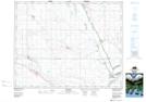
Maps showing Fox Point, 9-23-23-W2, Saskatchewan
Fox Point is a Cape located in 9-23-23-W2, Saskatchewan and has an elevation of 500 meters.
- Latitude: 50° 57' North (decimal: 50.9500375)
- Longitude: 105° 9' West (decimal: -105.1505698)
- Topography Feature Category: Cape
- Geographical Feature: Point
- Canadian Province/Territory: Saskatchewan
- Elevation: 500 meters
- Location: 9-23-23-W2
- Atlas of Canada Locator Map: Fox Point
- GPS Coordinate Locator Map: Fox Point Lat/Long