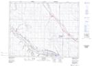
Maps showing Chamberlain, 8-22-26-W2, Saskatchewan
Chamberlain is a Village located in 8-22-26-W2, Saskatchewan and has an elevation of 561 meters.
- Latitude: 50° 51' 8'' North (decimal: 50.8523139)
- Longitude: 105° 34' 9'' West (decimal: -105.5692288)
- Topography Feature Category: Village
- Geographical Feature: Village
- Canadian Province/Territory: Saskatchewan
- Elevation: 561 meters
- Location: 8-22-26-W2
- Atlas of Canada Locator Map: Chamberlain
- GPS Coordinate Locator Map: Chamberlain Lat/Long