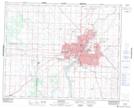
Maps showing Chappell, 1-36-6-W3, Saskatchewan
Chappell is a Unincorporated area located in 1-36-6-W3, Saskatchewan and has an elevation of 490 meters.
- Latitude: 52° 6' North (decimal: 52.1000436)
- Longitude: 106° 43' West (decimal: -106.7172810)
- Topography Feature Category: Unincorporated area
- Geographical Feature: Railway Point
- Canadian Province/Territory: Saskatchewan
- Elevation: 490 meters
- Location: 1-36-6-W3
- Atlas of Canada Locator Map: Chappell
- GPS Coordinate Locator Map: Chappell Lat/Long
Chappell NTS Map Sheets